![](/images/other/stat-length.png)
![Excursión Bici de montaña Les Sables-d'Olonne - Circuit Des Sauniers depuis la Pironiere - Photo](https://media.geolcdn.com/t/1900/400/25dd4c19-8439-43c0-ba96-cec0bf780ec5.jpeg&format=pjpeg&maxdim=2)
Circuit Des Sauniers depuis la Pironiere
Gregory Herlaud
Usuario
![Longitud](/images/other/stat-length.png)
Longitud
39 km
![Altitud máxima](https://static1.geolcdn.com/siteimages/upload/files/1508320355ic_sort_altitude_max_24dp.png)
Altitud máxima
25 m
![Desnivel positivo](https://static1.geolcdn.com/siteimages/upload/files/1508320355ic_sort_den_pos_24dp.png)
Desnivel positivo
214 m
![Km-Effort](/images/other/stat-length.png)
Km-Effort
42 km
![Altitud mínima](https://static1.geolcdn.com/siteimages/upload/files/1508320355ic_sort_altitude_min_24dp.png)
Altitud mínima
-2 m
![Desnivel negativo](https://static1.geolcdn.com/siteimages/upload/files/1508320355ic_sort_den_neg_24dp.png)
Desnivel negativo
215 m
![Boucle](https://static1.geolcdn.com/siteimages/upload/files/16400158638029165_repeat_loop_refresh_sync_direction_icon.png)
Boucle
Sí
Fecha de creación :
2020-06-27 18:13:34.881
Última modificación :
2020-07-02 17:18:25.742
![Bici de montaña](https://static1.geolcdn.com/sitytour/trail-icons/202.png)
2h56
Dificultad : Medio
![Escanee este código QR para abrir la excursión en la aplicación SityTrail](https://capi.geolives.com/qq0zvz2zws4bq2lad0pu/sitytour/trails/2452685/qr.png?size=200)
Aplicación GPS de excursión GRATIS
A propósito
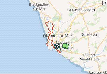
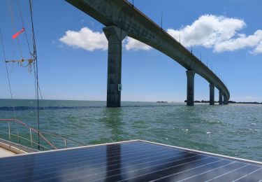
Ruta Bici de montaña de 39 km a descubrir en Países del Loira, Vandea, Les Sables-d'Olonne. Esta ruta ha sido propuesta por Gregory Herlaud.
Descripción
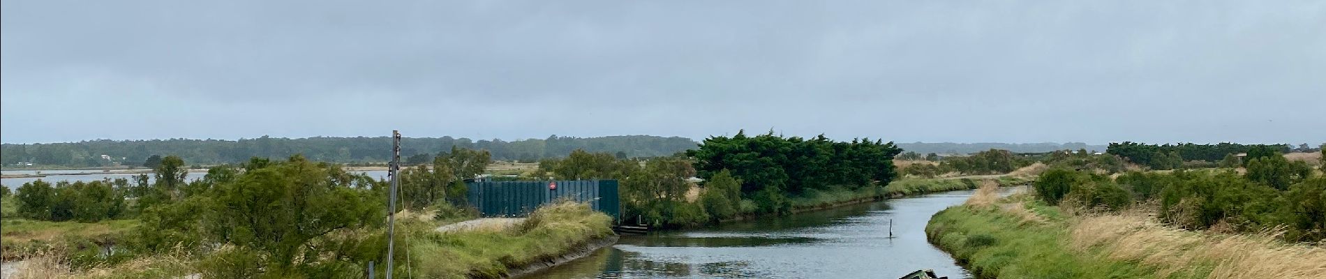
Les Marais salants du Pays des d'Olonne.
Traversé des Sables d'Olonne, du port, des marais Salant.
Localización
País:
France
Región :
Países del Loira
Departamento/provincia :
Vandea
Municipio :
Les Sables-d'Olonne
Localidad:
Château-d'Olonne
Salida:(Dec)
Salida:(UTM)
595870 ; 5148340 (30T) N.
Comentarios
Excursiones cerca
![Excursión Bici de montaña Les Sables-d'Olonne - Pironnière vers le Veillon (le Cul d’Âne) - Photo](https://media.geolcdn.com/t/375/260/853eb98e-16c5-41f1-9677-bb9cf1715cef.jpeg&format=jpg&maxdim=2)
![Bici de montaña Bici de montaña](https://static1.geolcdn.com/sitytour/trail-icons/202.png)
Pironnière vers le Veillon (le Cul d’Âne)
Bici de montaña
Medio
(1)
Les Sables-d'Olonne,
Países del Loira,
Vandea,
France
![](/images/other/stat-length.png)
22 km | 25 km-effort
1h 58min
![](https://static1.geolcdn.com/siteimages/upload/files/16400158638029165_repeat_loop_refresh_sync_direction_icon.png)
Sí
![Excursión Cicloturismo Les Sables-d'Olonne - Activity - Photo](https://media.geolcdn.com/t/375/260/ext.jpg?maxdim=2&url=https%3A%2F%2Fstatic1.geolcdn.com%2Fsiteimages%2Fupload%2Ffiles%2F1524743154velo.jpg)
![Cicloturismo Cicloturismo](https://static1.geolcdn.com/sitytour/trail-icons/204.png)
Activity
Cicloturismo
Muy fácil
(1)
Les Sables-d'Olonne,
Países del Loira,
Vandea,
France
![](/images/other/stat-length.png)
45 km | 49 km-effort
4h 10min
![](https://static1.geolcdn.com/siteimages/upload/files/16400158638029165_repeat_loop_refresh_sync_direction_icon.png)
No
![Excursión Senderismo Les Sables-d'Olonne - les Sables d'olonne - Photo](https://media.geolcdn.com/t/375/260/ext.jpg?maxdim=2&url=https%3A%2F%2Fstatic1.geolcdn.com%2Fsiteimages%2Fupload%2Ffiles%2F1553511878bg_sport_marche.png)
![Senderismo Senderismo](https://static1.geolcdn.com/sitytour/trail-icons/101.png)
les Sables d'olonne
Senderismo
Muy fácil
(1)
Les Sables-d'Olonne,
Países del Loira,
Vandea,
France
![](/images/other/stat-length.png)
5,8 km | 6,3 km-effort
1h 29min
![](https://static1.geolcdn.com/siteimages/upload/files/16400158638029165_repeat_loop_refresh_sync_direction_icon.png)
Sí
![Excursión Bici de montaña Les Sables-d'Olonne - 16-08-13 - Photo](https://media.geolcdn.com/t/375/260/ext.jpg?maxdim=2&url=https%3A%2F%2Fstatic1.geolcdn.com%2Fsiteimages%2Fupload%2Ffiles%2F1524743154velo.jpg)
![Bici de montaña Bici de montaña](https://static1.geolcdn.com/sitytour/trail-icons/202.png)
16-08-13
Bici de montaña
Fácil
(1)
Les Sables-d'Olonne,
Países del Loira,
Vandea,
France
![](/images/other/stat-length.png)
38 km | 41 km-effort
2h 26min
![](https://static1.geolcdn.com/siteimages/upload/files/16400158638029165_repeat_loop_refresh_sync_direction_icon.png)
No
![Excursión Senderismo Les Sables-d'Olonne - moulin saint jean - Photo](https://media.geolcdn.com/t/375/260/ext.jpg?maxdim=2&url=https%3A%2F%2Fstatic1.geolcdn.com%2Fsiteimages%2Fupload%2Ffiles%2F1553511878bg_sport_marche.png)
![Senderismo Senderismo](https://static1.geolcdn.com/sitytour/trail-icons/101.png)
moulin saint jean
Senderismo
Muy fácil
(3)
Les Sables-d'Olonne,
Países del Loira,
Vandea,
France
![](/images/other/stat-length.png)
11,7 km | 12,6 km-effort
2h 41min
![](https://static1.geolcdn.com/siteimages/upload/files/16400158638029165_repeat_loop_refresh_sync_direction_icon.png)
No
![Excursión Velero Les Sables-d'Olonne - Turballe retour - Photo](https://media.geolcdn.com/t/375/260/6f856a52-15a7-4996-bd60-5fb43f6c48a4.jpg&format=jpg&maxdim=2)
![Velero Velero](https://static1.geolcdn.com/sitytour/trail-icons/702.png)
Turballe retour
Velero
Difícil
Les Sables-d'Olonne,
Países del Loira,
Vandea,
France
![](/images/other/stat-length.png)
92 km | 92 km-effort
10h 16min
![](https://static1.geolcdn.com/siteimages/upload/files/16400158638029165_repeat_loop_refresh_sync_direction_icon.png)
No
![Excursión Velero Les Sables-d'Olonne - Descente vers le sud 4eme étapes les Sables d'Olonne la Rochelle - Photo](https://media.geolcdn.com/t/375/260/35e85cd5-b947-488a-8361-e76e6406ff94.jpg&format=jpg&maxdim=2)
![Velero Velero](https://static1.geolcdn.com/sitytour/trail-icons/702.png)
Descente vers le sud 4eme étapes les Sables d'Olonne la Rochelle
Velero
Medio
Les Sables-d'Olonne,
Países del Loira,
Vandea,
France
![](/images/other/stat-length.png)
65 km | 65 km-effort
7h 35min
![](https://static1.geolcdn.com/siteimages/upload/files/16400158638029165_repeat_loop_refresh_sync_direction_icon.png)
No
![Excursión Senderismo Les Sables-d'Olonne - la Chaume Paracou - Photo](https://media.geolcdn.com/t/375/260/ext.jpg?maxdim=2&url=https%3A%2F%2Fstatic1.geolcdn.com%2Fsiteimages%2Fupload%2Ffiles%2F1553511878bg_sport_marche.png)
![Senderismo Senderismo](https://static1.geolcdn.com/sitytour/trail-icons/101.png)
la Chaume Paracou
Senderismo
Fácil
(2)
Les Sables-d'Olonne,
Países del Loira,
Vandea,
France
![](/images/other/stat-length.png)
12,3 km | 13,4 km-effort
3h 6min
![](https://static1.geolcdn.com/siteimages/upload/files/16400158638029165_repeat_loop_refresh_sync_direction_icon.png)
Sí
![Excursión Senderismo Les Sables-d'Olonne - Orbestier Fradin les vallées - Photo](https://media.geolcdn.com/t/375/260/ext.jpg?maxdim=2&url=https%3A%2F%2Fstatic1.geolcdn.com%2Fsiteimages%2Fupload%2Ffiles%2F1553511878bg_sport_marche.png)
![Senderismo Senderismo](https://static1.geolcdn.com/sitytour/trail-icons/101.png)
Orbestier Fradin les vallées
Senderismo
Fácil
(1)
Les Sables-d'Olonne,
Países del Loira,
Vandea,
France
![](/images/other/stat-length.png)
12,2 km | 13,3 km-effort
2h 48min
![](https://static1.geolcdn.com/siteimages/upload/files/16400158638029165_repeat_loop_refresh_sync_direction_icon.png)
Sí